Cambodia geography and climate
Geography
Being a part of the Indochina peninsula to the southwest and spreading on a total area of around 181,040 kilometers square, Cambodia is surrounded by Thailand and Laos on the north, by Vietnam on the east and southeast, and by the Gulf of Thailand on the west. Besides the main terrain of rolling plains, the large Tonle Sap Lake and the Mekong River located almost central running throughout the country is the 12th longest river in the world.
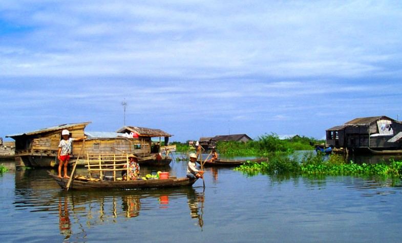
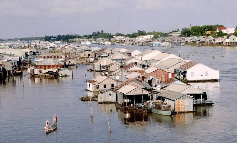
The Tonle Sap Basin together with the Mekong Lowlands forms the largest part of Cambodia which accounts for around 75%. In detail, the Mekong Delta lies on the southeast of the basin expanding through Vietnam to the China Sea’s southern area. Mountain ranges including Elephant Range and Cardamom Mountains bound the basin to the southwest and Dangrek Mountains to the north. The northeast and east regions of the higher land integrate into Vietnam’s southern Central Highlands.
Both the Tonle Sap Basin and Mekong Lowlands region contain mostly plains with various elevations of less than 100 meters. The more increased the elevations are, the more rolled and steep they are.
Situated in the southwest, the Cardamom Mountains’ is over 1,500 meters’ height. Among them, Phnom Aural lying on the east of the range is the highest mountain at 1,771 meters’ height and the Elephant Range ‘s extension reaches the height ranging from 500 to 1,000 meters. Dangrek Mountains, locating on the Tonle Sap Basin ‘s northern rim, comprise a cliff with an average height of about 500 meters to 700 meters facing southward and being the Korat Plateau in Thailand ‘s southern edge. The watershed running along the cliff is a natural boundary between 2 countries: Thailand and Cambodia.
The Mekong Valley, a great communication route between Cambodia and Laos, divides Dangrek Mountains’ eastern end and the northeastern highlands. Lying in the southeast area, the basin merges the Mekong Delta which extends into the neighbor Vietnam, offers not only water but also land communications.
Climate
Being one of the countries in Southeast Asia, Cambodia has a typically tropical climate with different seasons changing in a year. The rainy season lasts from May to September or early October while the dry season falls on 5 months from November to March. The transitional periods between each season happen shortly as they just change the humidity and not too much temperature difference.
In general, the average temperatures of the Tonle Sap Basin area range from around 25 °C (77.0 °F) to 28.0 °C (82.4 °F). Sometimes, it reaches 38 °C (100.4 °F) but it is normally the signal of the rainy season’s beginning. Cambodia ‘s coolest month is January with a temperature of less than 10 °C (50 °F). The average total annual rainfall is estimated from 1,000 to 1,500 millimeters, and the heaviest amounts are recorded in the southeast region. The humidity is high at night time all year round (around 90%) while during the daytime, it is quite low in the dry season (around 50%), but increases in the rainy period.
Maybe you like our Cambodia Tours and Southeast Asia Tours (include Cambodia): Highlights of Cambodia Tour | Siam Reap & Angkor Cycling tour | Best of Vietnam Cambodia tour package 2023/2024 | Must-sees of Cambodia Laos Vietnam Tour - 19 days itinerary | Spectacular Thailand Vietnam Cambodia Tour

.jpg)
.jpg)